As we all know, on July 23, 2024, India’s Finance Minister, Nirmala Sitharaman, presented the budget along with Bhu Aadhaar . This budget includes various significant announcements for farmers. In addition, Finance Minister Sitharaman has introduced several proposals aimed at land management. Notably, every piece of land will now have a unique identification number, similar to an Aadhaar card. On Tuesday, Union Finance Minister Nirmala Sitharaman unveiled a series of reforms, with one key proposal focusing on land management in both rural and urban areas.
Unique Land Parcel Identification Number (ULPIN)
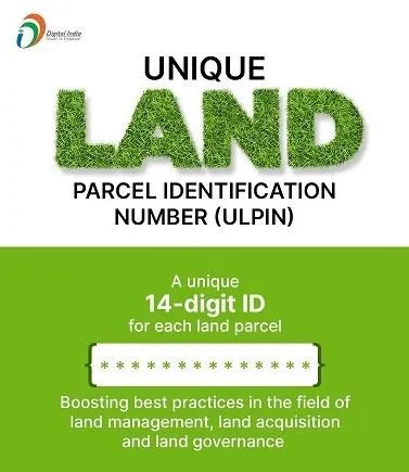
The Unique Land Parcel Identification Number (ULPIN) is a central component of the Digital India Land Records Modernization Programme (DILRMP). ULPIN assigns a unique 14-digit identification number to each land parcel, determined by the parcel’s specific longitude and latitude coordinates. This system relies on comprehensive surveys and geo-referenced cadastral maps to ensure accuracy.

ULPIN serves as a single, authoritative source of truth for all information related to any parcel of land or property. This provides integrated land services to citizens and stakeholders alike. The ULPIN system adheres to international standards, specifically those set by the Electronic Commerce Code Management Association (ECCMA) and the Open Geospatial Consortium (OGC).
What is ULPIN/Bhu-Aadhaar?
ULPIN, also known as Bhu-Aadhaar, is a 14-digit unique identification number assigned to each plot of land in India. This initiative is part of the Digital India Land Records Modernization Programme (DILRMP), which was launched in 2008. The project’s goal is to digitize land records across India and establish a comprehensive land records management system.
Bhu Aadhaar Proposal in Budget
1) Finance Minister Nirmala Sitharaman made a proposal to introduce a land-based identification system. However, there is still uncertainty about whether state governments will accept the Centre’s reform proposals, with officials providing no clear response on this matter.
2) The budget includes plans to implement a Unique Land Parcel Identification Number (ULPIN) system for all rural land. This system will digitize all government land information, similar to the Aadhaar card, with each piece of land having its own unique number.
3) Currently, landowners are responsible for conducting land-based surveys, which result in the creation of a map. These maps will be maintained by state governments.
4) The budget also proposes that farmers’ registrations be linked with their land, requiring a system to facilitate this connection.
5) There will be geographically digital maps created for proposed city areas under the Centre’s plan.
6) Property and tax-related systems will need to be based on information technology.
7) The Finance Minister emphasized the need to reform the processes for administering and managing land, as well as the planning systems.
8) The budget also calls for reforms in laws related to urban planning, land use, and housing. Some states have already begun taking steps to prepare the necessary maps for these changes.
Objectives of ULPIN/Bhu-Aadhaar
Assign Unique IDs: Provide a unique identification number for each plot of land to simplify record identification and retrieval.
Create Accurate Digital Records: Develop precise digital land records that include details such as land ownership, plot boundaries, area, and usage.
Link Land Records and Property Registration: Integrate land records with property registration processes for streamlined management.
Facilitate Online Services: Enable the online delivery of land record services for greater accessibility and convenience.
Assist in Government Planning: Maintain up-to-date land data to support effective government planning and decision-making.
How Bhu-Aadhaar is done :
Geotagging: The plot is first geotagged using GPS technology to determine its exact geographic location.
Surveying: Land surveyors physically verify and measure the plot boundaries to ensure accuracy.
Attribute Data Collection: Information such as the landowner’s name, plot area, and usage category is collected.
Data Entry: The collected details are entered into the land records management system.
ULPIN Generation: The system then generates a unique 14-digit ULPIN, which is linked to the digital record of the plot.
The 14-digit ULPIN incorporates the following embedded information:
- State Code
- District Code
- Sub-District Code
- Village Code
- Unique Plot ID Number
Once generated, the ULPIN will be stamped on the physical land record document that the landowner holds. This unique identification number will be permanently associated with the plot, ensuring its ongoing linkage to the digital record and facilitating future transactions and updates related to the land. The ULPIN remains permanently associated with the plot of land, regardless of any changes such as transfers or subdivisions.
NPS Vatsalya Scheme
Pradhan Mantri Janjatiya Unnat Gram Abhiyan
ICDS Recruitment 2024 West Bengal
Madhyamgram Municipality Recruitment 2024
CBSE 10th Compartment Result 2024
West Bengal Madhyamik Routine 2025
Implementation Status of Bhu Aadhaar ( Property Aadhaar )
Bhu Aadhaar has been implemented across 29 states and union territories in India. These include Andhra Pradesh, Jharkhand, Goa, Bihar, Odisha, Sikkim, Gujarat, Maharashtra, Haryana,Rajasthan, Tripura, Chhattisgarh, Jammu & Kashmir, Assam, Nagaland, Mizoram, Madhya Pradesh,Tamil Nadu, Punjab, Dadra and Nagar Haveli & Daman and Diu, Himachal Pradesh, West Bengal, Uttar Pradesh, Uttarakhand, Kerala, Ladakh, Chandigarh, Karnataka, and the National Capital Territory of Delhi.
In addition to the widespread implementation, pilot testing for ULPIN has been conducted in four states and union territories: Puducherry, Telangana, Manipur, and the Andaman & Nicobar Islands.States such as Madhya Pradesh, Ladakh, and Jammu & Kashmir are also utilizing ULPIN within the SVAMITVA scheme.
The Digital India Land Records Modernization Programme, which includes the implementation of ULPIN/Bhu-Aadhaar, has made notable strides across various states:
- Andhra Pradesh was the first to achieve 100% ULPIN coverage, with over 60 million land parcels assigned unique ULPINs.
- Karnataka, Odisha, Telangana, Madhya Pradesh, and Chhattisgarh are also leading in ULPIN coverage, reaching between 60% and 90%.
- Five states have fully integrated their registration and land records systems through ULPIN so far.
- As of the latest government data, approximately 50% of the total land parcels in India have been assigned ULPINs.
- Thirteen States have implemented online delivery of land records to citizens using Bhu-Aadhaar/ULPIN.
- To boost ULPIN coverage, some states are utilizing drone surveying and geo-tagging technologies.
However, progress varies:
- Uttar Pradesh, Bihar, and Assam are lagging in ULPIN implementation due to administrative and operational challenges.
- The absence of digitized cadastral maps has also hindered record integration in some areas.
Despite these challenges, the objective is to achieve comprehensive ULPIN integration across India by 2025.
Future Potential and Applications
In the future, ULPIN/Bhu-Aadhaar can be integrated with various applications to significantly enhance service delivery for farmers. Potential integrations include:
- Agricultural Credit: Streamlining the process for farmers to access loans by linking land records with credit systems.
- Soil Health Cards: Combining land identification with soil health data to provide tailored recommendations for soil management.
- Irrigation Facilities: Facilitating better planning and allocation of irrigation resources based on accurate land data.
ULPIN will be instrumental in modernizing India’s land records system and improving land governance.
Challenges
There are several challenges that need to be tackled in the rollout of ULPIN/Bhu-Aadhaar:
- Updating Land Records: Digitizing cadastral maps with precise latitude and longitude data is a complex process that requires substantial effort.
- Target Achievement: Meeting the targets for full implementation by March 2024 or even March 2026 is challenging due to the complex nature of land laws.
- Feasibility and Sustainability: The costs associated with implementing ULPIN, combined with the Department of Land Resources’ limited financial resources, raise concerns about the project’s feasibility and long-term sustainability.
Significance
The establishment of a unified nationwide ID for land parcels offers several crucial benefits:
- Prevention of Land Fraud: A unique identification number will help prevent land fraud, especially in rural areas where land records are often outdated and disputed.
- Mitigating Disputes: The digitization and standardization of land records and registration are expected to reduce the high number of court cases related to land disputes.
- Collateral for Loans: It will enable farmers to use their land as collateral to secure loans from banks, enhancing their access to financial resources.
Conclusion
In summary, the rollout of ULPIN/Bhu-Aadhaar is a major step toward revolutionizing India’s land records system. This initiative aims to make land management more transparent and efficient by assigning unique identification numbers to each land parcel. While significant progress has been made with widespread implementation and pilot testing, there are still hurdles to overcome. Addressing these challenges will be key to realizing the full potential of ULPIN. As we move forward, it’s crucial to tackle these issues and fully integrate ULPIN into various applications to enhance land governance and service delivery nationwide.